Cartography

Thirteen ways to draw
one island & one way
to draw them all.

Two pieces of work, both ready to print. First, Mauke drawn thirteen different ways — so the Sun can choose a house style by looking at it rather than describing it. Then the one you chose, Watercolour Botanical, applied to every island in the country. Click either to open the live version.

Prepared for

Cook Islands Sun

Round

Style Review 01

Status

Awaiting Feedback

28
print-ready sheets
15
islands drawn
A3
420 × 297 mm, vector
0
lines traced by eye
01. Style Selection

Mauke, thirteen ways

One island · Thirteen aesthetics · Same survey

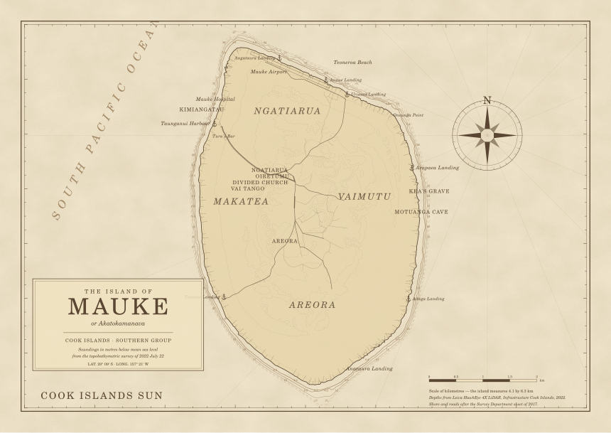
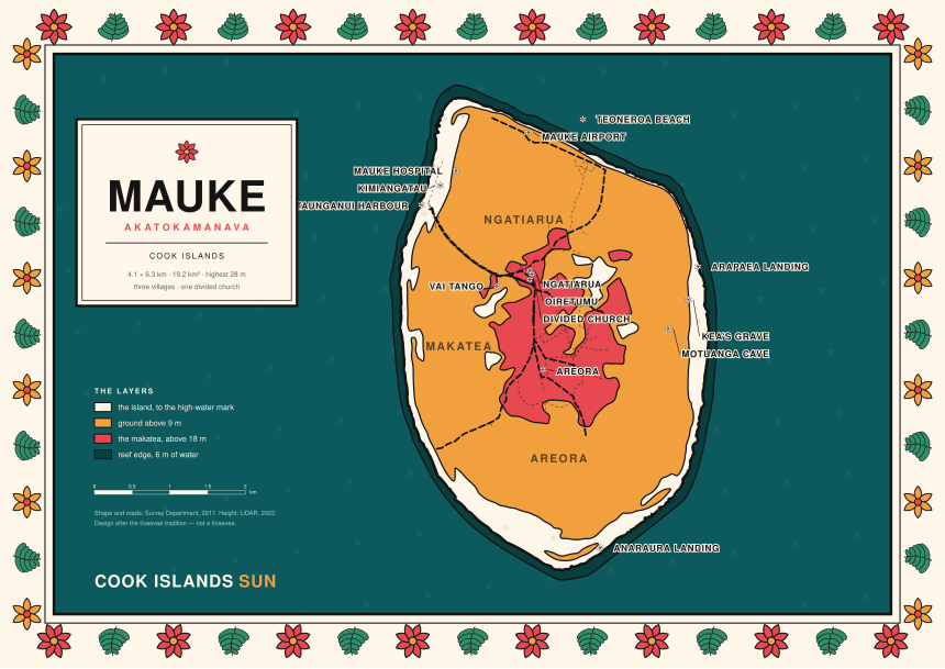
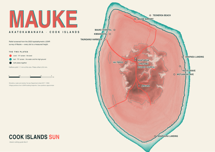
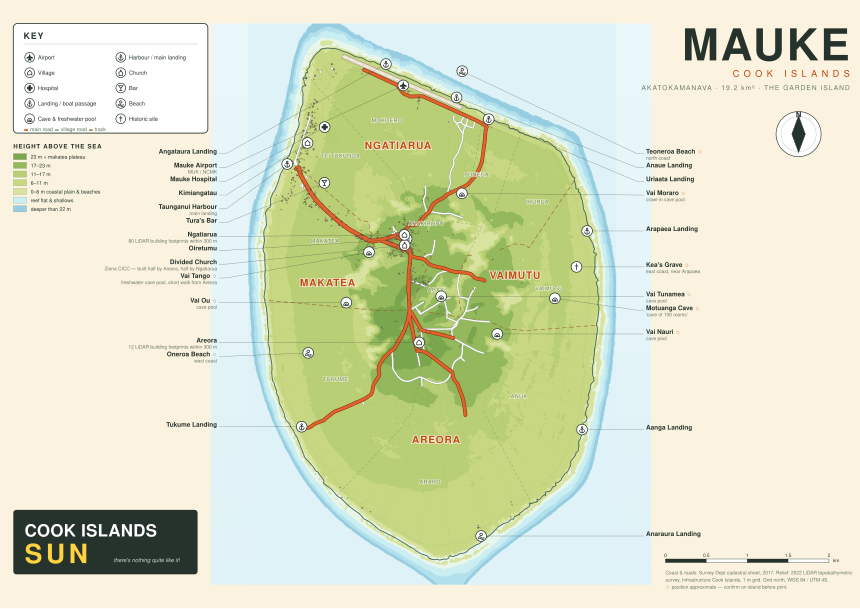
The same island drawn thirteen times. Style 01 rebuilds the Sun's existing house style — the look readers know from last year's Rarotonga map — from the survey rather than by hand. Six more are alternatives drawn from the same data; six again are made with an image model in the register a tourism magazine actually prints in.

Every one of them is the same island in the same place. What changes is only the hand.

Range
  • · Seven vector sheets, print-ready SVG and PDF
  • · Six generated variants, unlabelled, for a designer to letter over
  • · Built from the 2022 LiDAR survey and the 2017 cadastral sheet
View the thirteen
02. The Chosen Style, Everywhere

The Cook Islands, painted

Fifteen islands · One style · Both groups

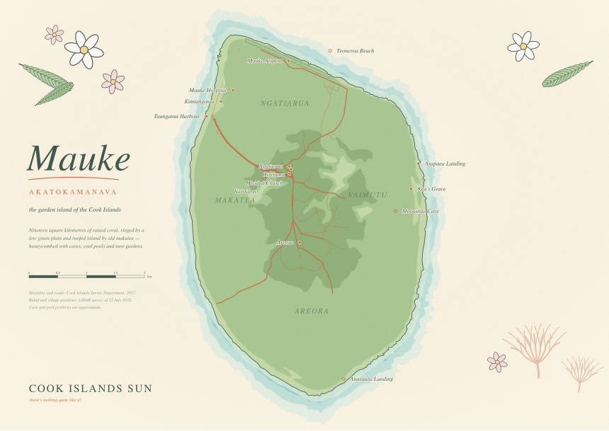
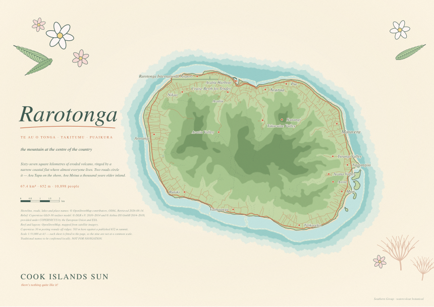
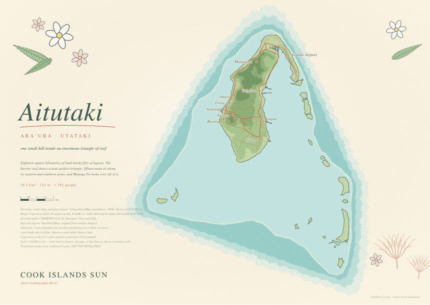
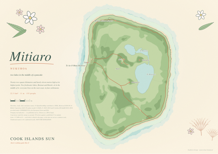
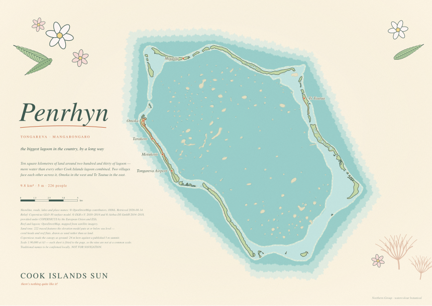
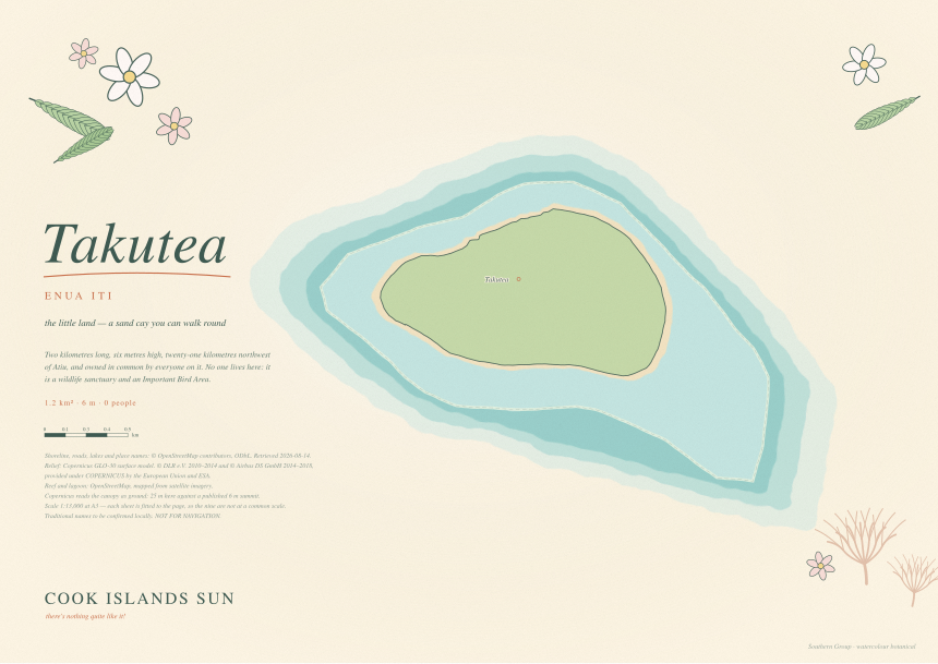
You picked Watercolour Botanical, so it was rebuilt as a renderer that takes any island and run over all fifteen — the nine of the Southern Group and the six of the Northern. Same paper, same washes, same italic hand, same masthead.

Lay them out together and they read as one publication. Look at any one and it is unmistakably itself — Aitutaki's triangle of reef, Mitiaro's two lakes, Penrhyn's lagoon full of coral heads.

Palette
  • · Fifteen A3 sheets, print-ready SVG and PDF
  • · Real coastlines, real relief, real place names
  • · Every uncertain line disclosed on the sheet that carries it
View the fifteen
A few of the sheets

Scroll sideways. Every one of these is an A3 vector master at 420 × 297 mm with a print PDF beside it.

Sun Classic, Mauke
01 · Sun Classic
Admiralty Chart, Mauke
03 · Admiralty Chart
Watercolour Botanical, Mauke
04 · Watercolour Botanical
Tivaevae, Mauke
06 · Tīvaevae
Risograph Duotone, Mauke
07 · Risograph Duotone
Rarotonga
Rarotonga
Aitutaki
Aitutaki
Mitiaro
Mitiaro
Penrhyn
Penrhyn
Takutea
Takutea
What's underneath

Nothing on these sheets
was drawn by eye.

The Mauke sheets come from the 2022 topobathymetric LiDAR survey flown for Infrastructure Cook Islands and the Survey Department's 2017 cadastral sheet. The other fourteen islands have no survey, so they are stitched from OpenStreetMap coastline and contoured from the Copernicus GLO-30 elevation model.

The cheapest check that it is right: the drawn land areas land on the published figures. Mauke 19.2 km² against a surveyed 19.2. Rarotonga 67.7 against 67.4. Penrhyn 9.9 against 9.8.

Every sheet carries its own provenance

Source, licence, retrieval date, scale ratio, and a measured height residual against the published summit — printed on the sheet itself, not in a separate note that gets lost.

Where it is uncertain, it says so

Four islands have no reef mapped anywhere and no published survey. Their sheets draw an indicative fringing band and say exactly that, in the same place on every sheet. Nine places on the Mauke sheets are marked approximate for the same reason.

Two things want local eyes before print

The traditional island names should be checked by a Cook Islands Māori speaker — and Pukapuka by a Pukapukan speaker, since its language is not the same. And someone on Mauke should confirm the nine approximate pins: the cave pools, the two beaches, Kea's grave.

Deliberately left out

The 2017 survey carries 253 named landowners against mapped parcels. That layer is in the source data and is on none of these sheets. Publishing names against land in a community this size is a different act from publishing geometry, and it isn't ours to make.